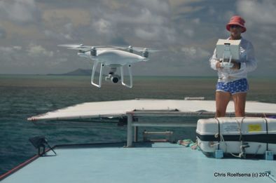
After a week of balancing tides, cloud cover, water clarity, sun angle, wind, and swell, Notus the Greek God of the South Wind finally got the better of us. We can’t complain, having lost only 2.5 days out of a 10 day trip in the completely exposed northern Great Barrier Reef during cyclone season. I think we’ve been incredibly lucky. Nonetheless, I still feel like I am on the steep part of the learning curve when it comes to flying drones despite dabbling for the past couple of years. This current field trip brought new challenges, the most notable being having to launch and recover from the roof of our boat.
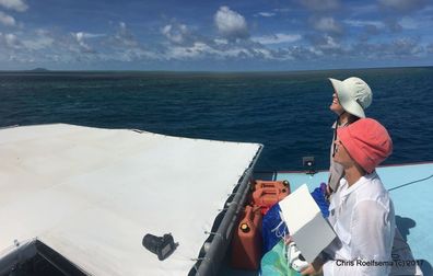
 Sun safe droning has us looking like grannies in the field :)
 With technology changing so rapidly, I find myself flying with a different configuration of drone / sensor / flight controller / ground station software each trip. For this particular trip I had to put aside my larger drones due to the small area for take-off and landing. Previously I have opted for the 3DR Solo if I wanted to fly in the sub 2kg category, but with a rocking boat underfoot, I knew that Betty and Shmoo wouldn’t be happy. This instability didn’t seem to bother Casper, my DJI Phantom 4 Pro, which also has the added benefit of the landing gear shaped like handles for the optional ‘catch’ if required.
In all honesty, I didn’t want to resort to catching. Something about soft skin around spinning propellers doesn’t make me comfortable. I’ve seen the YouTube video where the Phantom is used as a very efficient blender. Granted I think the props may have been changed for carbon fibre rather than plastic, but still.
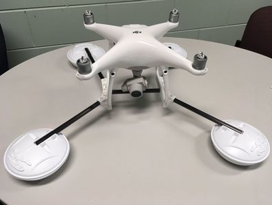
My alternative was to purchase the WaterStrider. Not that I intended to use this to land on the water, but I thought it would help out when landing on the boat’s unstable surface. I feel like the Phantom can tip quite easily on landing so I wanted to help it out. My first impressions of the Strider were that it was larger than I thought, and the floating pads looked GPS receivers. My second and final impression was that it is a good idea, but certainly poor execution.
As soon as Casper rose into the air with the Strider, I could tell that it was not going to be good. Casper struggled to stay balanced as the breeze caught the floats. He jerked and wobbled mid-air in a concerning manner. I brought him back to land immediately, and at least he didn’t tip. One of the rear motors was too hot to touch while the others were also rather warm. This was uncharacteristic of the craft so I knew it had been working hard in its short flight that can't have been longer than 2-3 minutes. This also suggested that it may have been unbalanced, so I checked the attachments and made a minor amendment.
I decided to have another try. I pushed Casper a little higher this time to increasingly worrying effect. This is clearly not a useful aid for me! The wind was less than 10kt and represented ‘normal’ conditions on the reef. Perhaps it performs better with no wind at all, but that is unrealistic in the marine environment for which I understand it has been designed. So back to the bare legged Casper. Sorry that I don’t have a video to share of this, but there is no way I want to re-enact it for you!
One bonus of the timing of this particular trip was that DJI released a new (free) flight planning app about two weeks ago – DJI GS Pro. It is a massive improvement on Litchi, which is the app that others had recommended I purchase. For survey purposes, I quickly found out that Litchi was near useless but I guess it was the best available for programming Phantoms. All my other drones fly with the pixhawk flight controller so I am used to programming with Tower (Android App) and Mission Planner (desktop), so I found the Phantom options seriously lacking. Having said that, the GS Pro app does a pretty good job and I think will only improve in the future. Here’s some of what we learned:
Things that need to be fixed in the app that I'll send to DJI :)
After this trip I finally got around to creating a gallery of some of the cool shots I have been lucky to capture since I started flying drones. Please check it out, and let me know what you think! Each picture has a science mission behind it, rather than being a carefully planned and framed image. One day I might get to writing and sharing their stories.
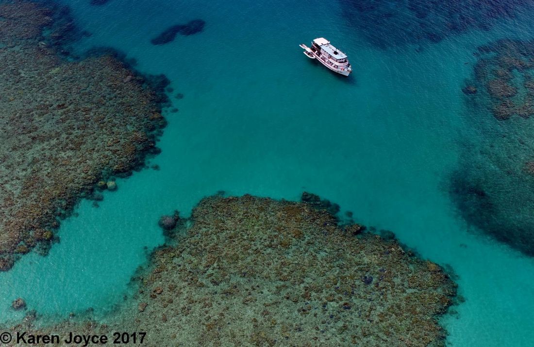
In all, we visited nine of the 3,000 odd reefs in the Great Barrier Reef. We'll be looking to combine our drone imagery with in-water snorkel and dive surveys and satellite imagery to create a map of the different reef habitats in the region. Thank you to Dr Chris Roelfsema and the team at University of Queensland for planning this trip and inviting me to be a part of the research. To the Great Barrier Reef Foundation for providing the funding. And to Dr Stephanie Duce who was a fantastic helper and #SheFlies new recruit for this trip!
I decided to have another try. I pushed Casper a little higher this time to increasingly worrying effect. This is clearly not a useful aid for me! The wind was less than 10kt and represented ‘normal’ conditions on the reef. Perhaps it performs better with no wind at all, but that is unrealistic in the marine environment for which I understand it has been designed. So back to the bare legged Casper. Sorry that I don’t have a video to share of this, but there is no way I want to re-enact it for you!
One bonus of the timing of this particular trip was that DJI released a new (free) flight planning app about two weeks ago – DJI GS Pro. It is a massive improvement on Litchi, which is the app that others had recommended I purchase. For survey purposes, I quickly found out that Litchi was near useless but I guess it was the best available for programming Phantoms. All my other drones fly with the pixhawk flight controller so I am used to programming with Tower (Android App) and Mission Planner (desktop), so I found the Phantom options seriously lacking. Having said that, the GS Pro app does a pretty good job and I think will only improve in the future. Here’s some of what we learned:
- A mission angle of 0deg means that the craft will always face easterly during the flight. It will fly forwards and backwards to keep it’s angle. At 180deg it will face west, and at 90deg it will face north. There is a bug such that it is not possible to fly at an angle anywhere between 270deg and 360deg. It is therefore not possible to fly with the drone and camera facing in a SE direction.
- To get the best mosaics, try to keep the survey to a square or rectangle shape, and make sure you have at least four runs.
- To minimise sunglint, fly between NW and SW in the morning, and between NE and SE in the afternoon. Except of course you can't fly SE at the moment using GS Pro... Choose whichever angle is most efficient between these brackets.
- Unless it is overcast, tilting the camera to about 15deg off nadir (while flying with your back end to the sun) significantly reduces glint. Make this angle even more oblique closer to midday. You can change the angle mid-flight to keep the glint away from the center of the image.
Things that need to be fixed in the app that I'll send to DJI :)
- Need to be able to type values in the different parameter fields rather than just using a slider bar. It was super hard to get the slider in exactly the right spot. A difference of just one degree in the flight angle could result in a whole extra minutes’ worth of flight.
- Add the ability to upload GPS or shapefile data to define mapping areas
- Fix the angles of flight between 270o and 360o
- Have an arrow on the flight lines when planning to show which way the craft will be facing
- Have an ‘undo’ button
- When sending the mission to the craft, minimise this information screen so it’s possible to see the map view behind. This would allow the pilot to manually fly to the start point of the survey, which is far more time efficient than flying at the survey pace.
- Every now and then it would stop taking photos during a survey for no apparent reason
- Time taken to upload the mission to the craft is variable. Sometimes it times out and the app needs to be closed and re-started
- Ability to flip which end the survey starts/finishes at
- Ability to switch to video
- Upon mission completion, it was curious that when pressing the photo button on the remote controller, the craft would continue to take photos at a regular time interval all the way home. This was actually kind of useful even though it felt like a bug
- At the end of the mission, the map, camera view, and telemetry should still be visible and updating – was otherwise having to pause the mission just before the end of the flight to keep this information on screen.
- Ability to visualise multiple flight plans at a time so it's possible to see if the areas overlap
- No auto zoom to the flight path
- Show gimbal angle with telemetry within the app
- Clearer scale bar - this was super hard to see over the imagery
- Better imagery and/or ability to upload your own
- Keep the blue bounding box of the survey area completely transparent
- Use the term landscape or portrait when referring to image capture orientation rather than parallel or perpendicular to flight path
After this trip I finally got around to creating a gallery of some of the cool shots I have been lucky to capture since I started flying drones. Please check it out, and let me know what you think! Each picture has a science mission behind it, rather than being a carefully planned and framed image. One day I might get to writing and sharing their stories.
In all, we visited nine of the 3,000 odd reefs in the Great Barrier Reef. We'll be looking to combine our drone imagery with in-water snorkel and dive surveys and satellite imagery to create a map of the different reef habitats in the region. Thank you to Dr Chris Roelfsema and the team at University of Queensland for planning this trip and inviting me to be a part of the research. To the Great Barrier Reef Foundation for providing the funding. And to Dr Stephanie Duce who was a fantastic helper and #SheFlies new recruit for this trip!


 RSS Feed
